
Many first-time visitors to Canyonlands National Park may not realize that the park was established not only for its scenic beauty but also for its significant archeology. People visit archeological and historic sites because they are a source of inspiration and demonstrate how past people lived in such a seemingly harsh climate. Archeological and historic sites are part of the cultural heritage of America and are irreplaceable.
We see evidence of people living, working, and traveling through Canyonlands over thousands of years. Together these cultural sites make up a landscape containing significant cultural heritage for many American Indians as well as explorers of European descent.
John Wesley Powell wrote his impressions of this region on his pioneering boat trip down the Green and Colorado rivers in 1889: “We glide through a strange, weird, grand region. The landscape everywhere, away from the river, is of rock.” Remarkably, 130 years later these rivers still run wild.
Above their confluence, the Green and Colorado meander through sheer-walled canyons. Below it, the combined waters start on a 14-mile rush through Cataract Canyon rapids – one of the nation’s most treacherous whitewater stretches. It rivals any in the Grand Canyon.
Most of the rock found in Canyonlands today is sedimentary, deposited from distant mountain ranges like the ancestral Rockies and even the Appalachians.
For those of you who have a significant “nerd” component to our being, we have included a geologic period map that illustrates the several dozen dominant layers in Canyonlands.
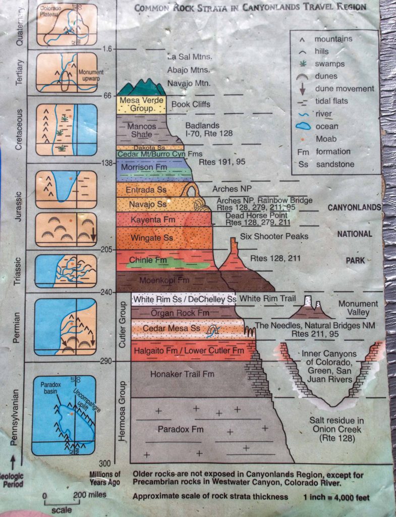
You closet archeologist can have fun spending many hours delving into the details of this map! We challenge you to map the details of this chart to our photographs! To give you a head start, the whitish, flat layers in the photograph below is White Rim Sandstone from the Permian Period. Incidentally, this White Rim Sandstone is critical to the varied relief of the canyon. If it were absent, all the features below would have simply eroded away.
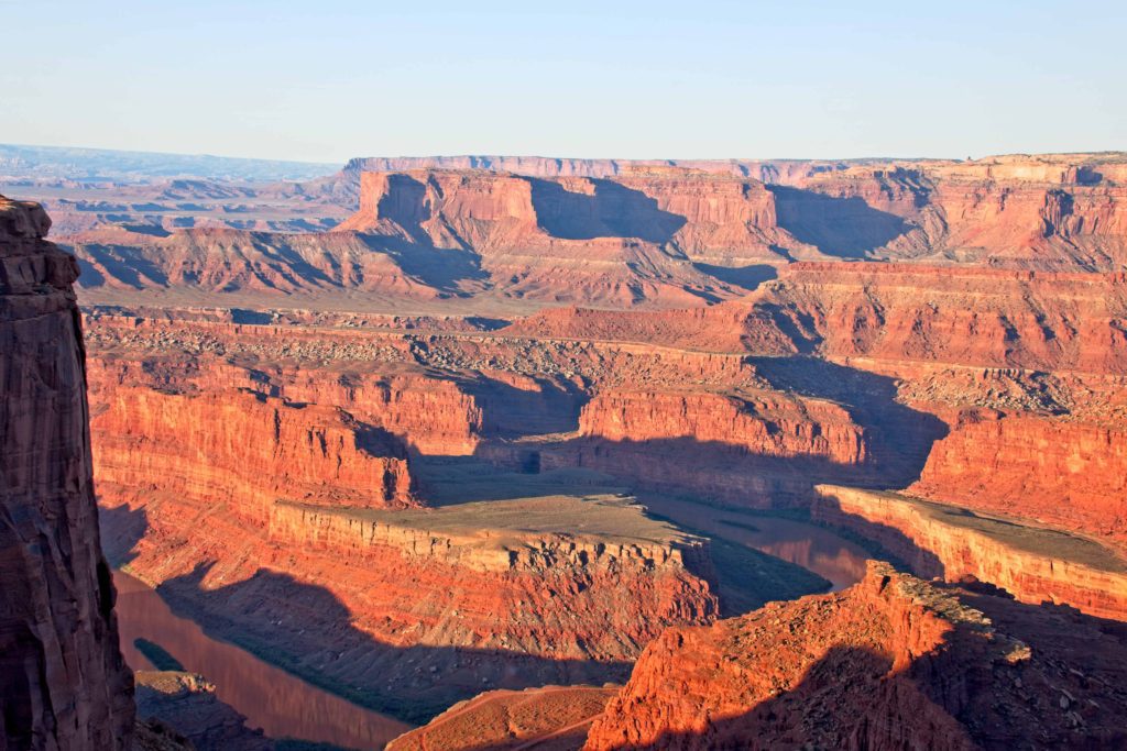
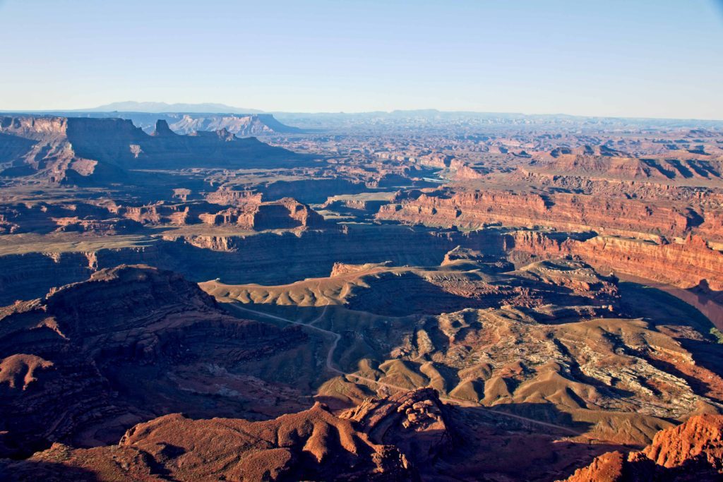
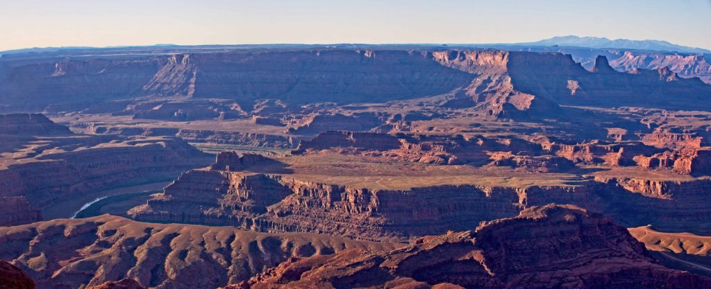
The above three photographs are early morning shots taken from Dead Horse Point. If you look closely you can identify the Colorado River as it meanders along.
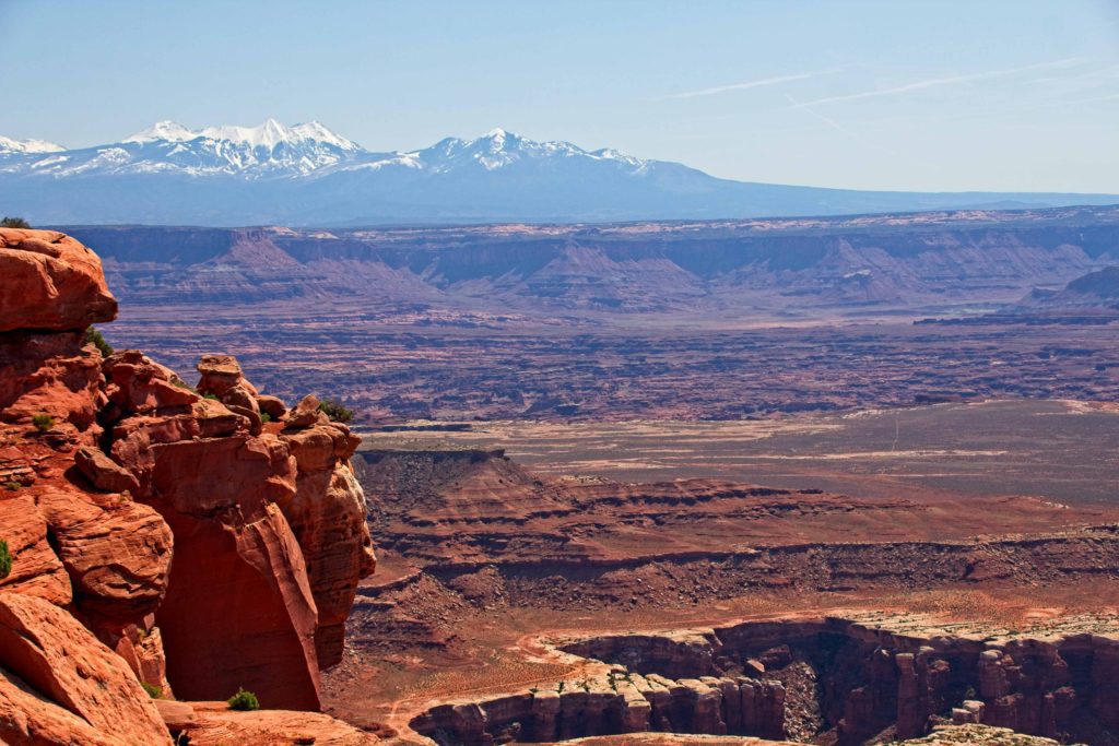
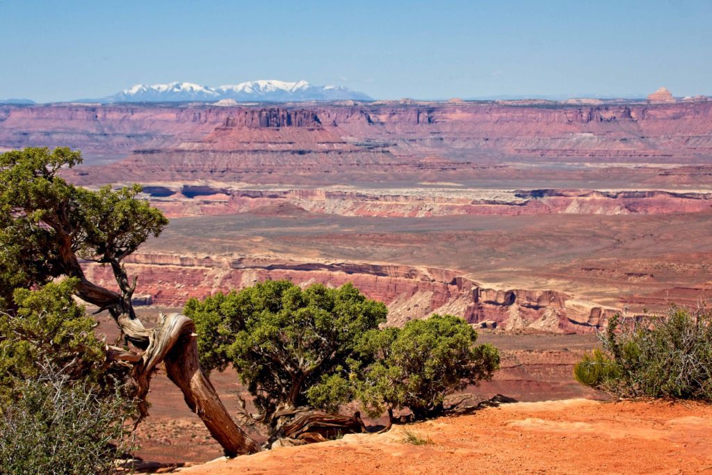

There are three distinct regions of Canyonlands, the Island in the Sky, the Needles, and the Maze. The above three photographs were taken from the “Island in the Sky” portion of Canyonlands. If you look closely at the photograph immediately above you can see a dirt road running along one of the mesas. This road was created by the US Government in the 1950s to encourage the prospecting and extraction of uranium. Today it can be traveled using a 4-wheeled drive vehicle.
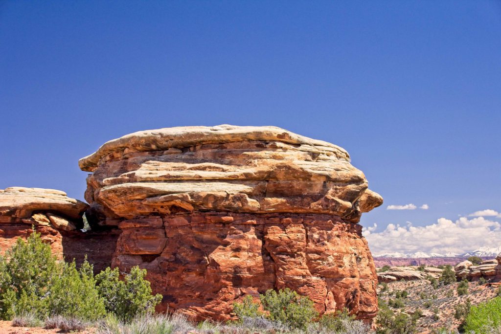

These last two photographs were taken in the Needles region of Canyonlands. Notice how the landscape has changed. These formations come from the Halgaito Shales formation (refer to your chart!)
One last bit of geology. Remember the posts from Arches? Formations in Arches were created by the erosion of Estrada Sandstone of the Jurassic Period, meaning Arches is much younger than Canyonlands.
maoThank you for educating us on your trips. The chart you included is very interesting in that it shows places where we have traveled—Badlands, Mesa Verde. I regret that we have not made into the heart of Utah, but your photos may be better. You go places where we would never venture.
HaroldWe are so glad you can appreciate it since you have been there and know what it is like.