Archeological studies across the Four Corners region have produced intriguing information about the past cultures inhabiting this part of the Southwest. Over 13,000 years ago nomadic, Paleo-Indian hunters roamed the plateaus and canyons hunting wild animals. Drier climate conditions displaced these people – as larger animals moved elsewhere – and ushered in Archaic hunter-gatherers from the west about 11,000 years ago. These people were eventually to become known as the ancestral Pueblo people.
The rocky, rugged, open country you will see in this series of photographs was once home to many people. For thousands of years, people hunted animals and gathered plants, moving on an annual cycle from the high mesas to the low canyon lands. As corn, or maize, gradually made its way north from Mexico, they became farmers and settled in villages. Along with corn, they grew beans, squash, and a grain called amaranth. There is also evidence they grow cotton.
At Hovenweep, population density varied over time. In the 1200s, increasing numbers of people concentrated at the heads of small canyons, where they built pit houses, pueblos (basically a single dwelling), ceremonial rooms – or kivas – and the towers that are Hovenweep’s trademark. Most of the buildings still standing were constructed from 1230 to 1275 AD, about the same time as the famous cliff dwellings at Mesa Verde.
In the late 1200s, prolonged drought, overuse of natural resources, and, possibly, internal strife led to the eventual abandonment of the region. These people settled in what are now the pueblos of the Rio Grande Valley in New Mexico, Texas, and the Hopi mesas of Arizona.
It is well known that some of these groups traded with others as far away as Mexico and California. Intriguing questions on how they communicated still plague archeologists today. One form of communication known to exist from as early as 14,000 years ago is petroglyphs. These petroglyphs (along with pictographs) became more prevalent as time passed. We now find hundreds of locations in the Southwest which harbor petroglyphs and pictographs. Some of the locations exhibit only a few, while others, like Newspaper Rock, and Sand Island display literally hundreds. So what do these petroglyphs and pictographs mean? What were those people trying to say? Many, many questions still remain.

The Ancients in the Southwest lived in three different types of dwelling during the period 500AD to 1300AD. The oldest was a pit dwelling (a pit in the ground covered with a roof of timber). They then developed a pueblo (usually a single family dwelling on top of a mesa). This photograph is an example of best-preserved pueblos, located at Edge of the Cedars State Park. From the exposed position of a pueblo, they migrated into what we now call cliff dwellings.

Hovenweep consists of six separate dwelling areas dispersed over dozens of miles. Its buildings were constructed during the same time as the more famous Mesa Verde cliff dwellings. At the Little Ruin Canyon site, we see the transition between pit houses to the start of cliff dwellings. This is a photograph of one of their pueblo dwellings located on the rim of the canyon.
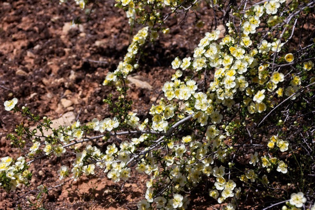
We were very fortunate on this trip to see wide areas of the Utah desert in bloom. An unusual amount of rain has resulted in many species of plants blooming in abundance. Some of these plans have not bloomed for years. Here is the Cliff Rose.

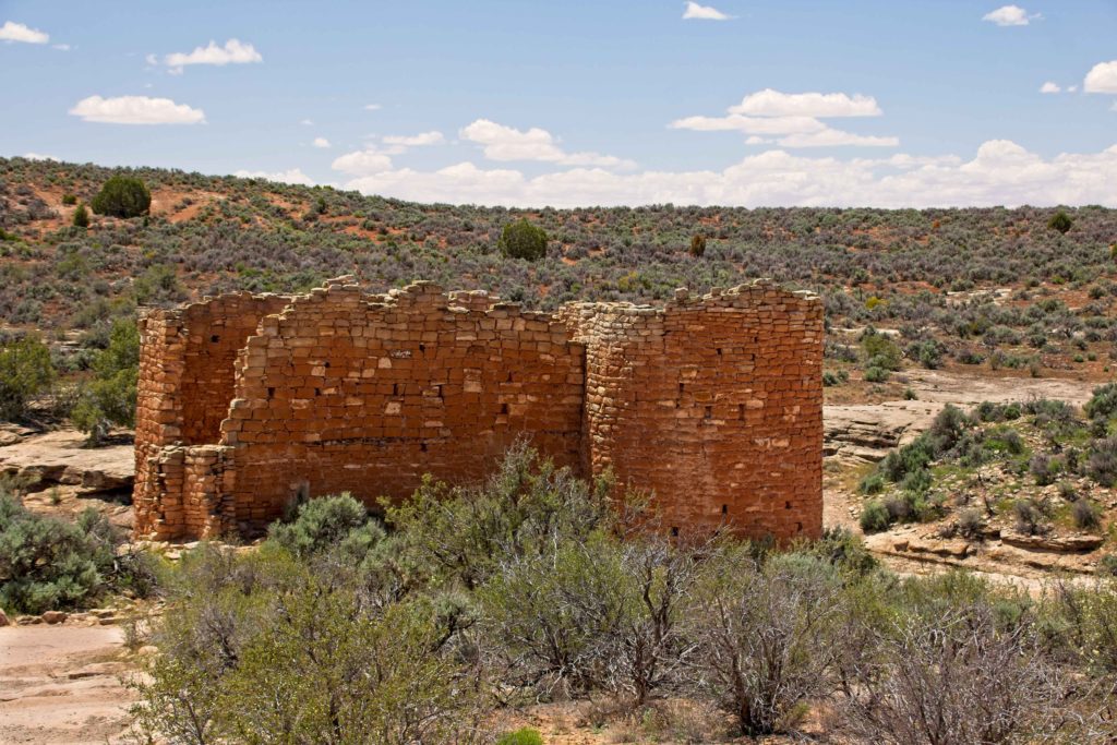
While Little Ruin Canyon of Hovenweep is not considered to be a classic Cliff Dwelling, we see here the beginnings of the transition. Twin Towers, seen from the opposite rim of the canyon, sitting on the other side. These two structures, together, had 16 rooms. The towers are among the most carefully-constructed buildings in the entire Southwest.
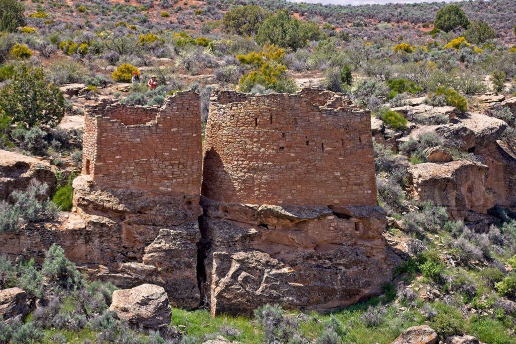
A closer view of Twin Towers. Note how they have been constructed on native bedrock.

Almost at the bottom of the canyon sits Eroded Boulder House. A close inspection reveals the remains of a dwelling built into the rock’s crevice.
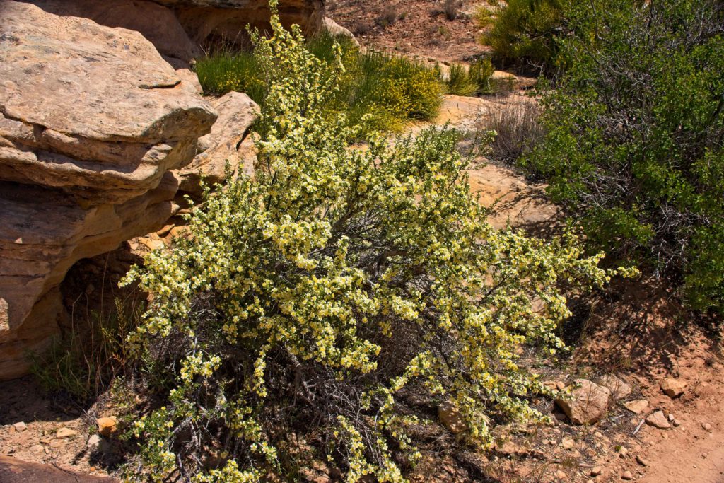
Another Cliff Rose. As mentioned previously, there were hundreds of these bushes in bloom around the Little Ruin Canyon site.
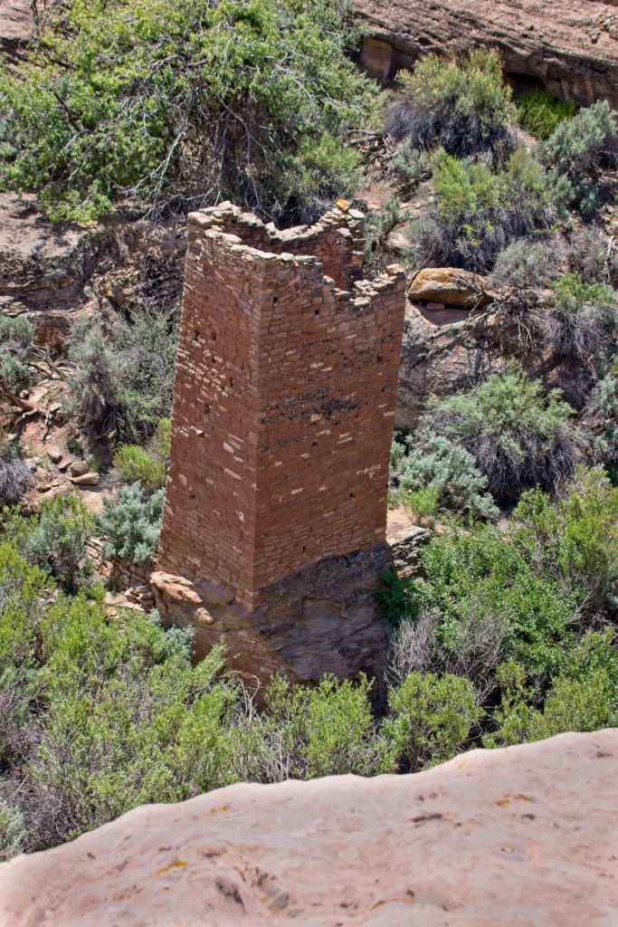
Located at the bottom of the canyon, is the two-story-tall Square Tower. The large hackberry trees growing beside the tower tell of the seep that trickles under its alcove. It was the presence of this precious permanent water source that held his settlement together.
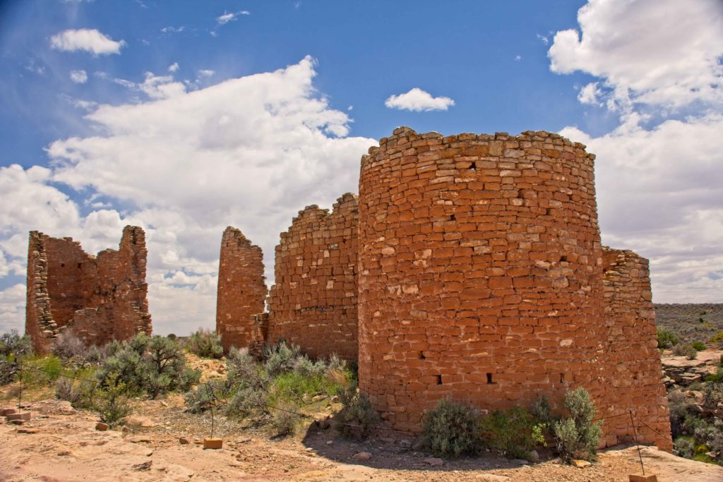
The two photographs above show Hovenweep Castle. It consists of two D-shaped towers perched on the rim of Little Ruin Canyon. The stone walls, two and three courses thick, show detailed masonry techniques. Growth rings on a wooden beam in one tower date to 1277 AD. A residence was associated with the “castle”, but the people who lived here were farmers, not any type of royalty.
SamHB & MB … I have really enjoyed the photos you have posted on your blog. It is enlightening to see images of yours that I previously have taken. I especially like the night sky ones, you will have to teach me how to do it.
HaroldThanks, Sam. Hopefully doing night skies will not be like the blind leading the blind!
David RayburnPeggy and I really enjoy your postings. Have a good trip and a return trip to BIG J.
HaroldThanks, David. We look forward to returning to Jefferson.
maoLove your explanations. I always enjoy your blog, and especially your photography. Love from Williamsburg
HaroldWe envy you being at Williamsburg. We love the place, Hope you are having a great time!